Sections
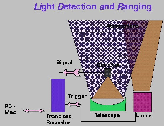
LiDAR is a remote sensing technology. It uses light in the form of pulsed laser which is used to measure different distances in the earth. It illuminates the target with laser and the reflected light is analyzed to measure the distance. It is mainly used to create high resolution maps which have lot of applications such as geology, remote sensing, forestry, etc. It is also used for atmospheric research and meteorology. It uses visible, ultraviolet, infrared lights to image objects. It can target various materials such as rock, clouds, non metallic objects etc. The narrow laser beam can easily map the physical features with high resolution. LIDAR instrument consists of laser, scanner, GPS receiver. The LIDAR instrument is fitted to satellites and aircrafts which can be used for surveying and mapping.

Figure above shows a LIDAR which is used to scan buildings, rock etc. It helps to produce a 3 dimensional model. It emits laser beam and has a wide range. The head is horizontally rotating and also consists of a vertically placed mirror. It will measure the distance from the object.
There are two types and they are coherent detection (direct detection) and incoherent detection. Coherent detection is more sensitive than incoherent detection. It requires small power. But it is expensive because of the use of complex transceivers.
The pulse models are of two types. They are:-
Micropulse lidar system:- It uses less energy in laser and can be used without any safety precautions. So it is called as “eye safe”.
High Power systems:- It is mainly used in atmospheric research. It is used to measure the atmospheric parameters such as height, density of clouds, properties of cloud particles, temperature, wind, pressure, humidity, gas concentration etc.

For non scientific applications, 600-1000nm lasers are most commonly used which are inexpensive. But it can easily absorbed by the eye. Eye safety is an important requirement in all applications. Another laser 1550nm are eye safe because it cannot absorb by the eye. It can be used in high power levels. It can be used in military applications because it is invisible in night vision goggles. Shorter laser pulses can achieve better target resolution.
The fastness of images developed depends on the speed at which they are scanned.
The main technologies used in LIDAR are solid state photo detectors such as photodiodes, photomultipliers.
To determine the orientation and position of sensor, it requires instrumentation. These devices consists of Global Positioning System (GPS) and an Inertial Measurement Unit(IMU).
The imaging lidar consists of arrays of high speed detectors and modulation sensitive detector arrays which is built on single chips.
There are lots of applications. Some of them are given below.
Sections